
A new hurricane called Melissa It reaches level 5 intensity, according to the National Office of Oceanic and Atmospheric Administration (NOAA). It is an “extremely dangerous” storm that threatens “catastrophic winds, flash flooding and storm surge,” the US agency has noted.
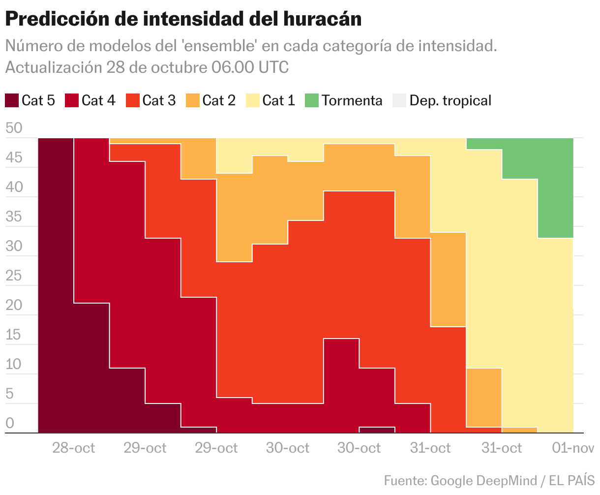
According to predictions, the storm that began in the Caribbean Sea has the islands of Jamaica and Cuba in its probable path. This is shown by the “ensemble model” of Google Deepmind.
The forecast of the experimental model is that the hurricane will cross Jamaica this Tuesday the 28th around 18:00 UTC (1:00 p.m. local time), with high probability and with intensity 4. The storm would reach Cuba on Wednesday the 29th shortly after 6:00 UTC, although its intensity would have predictably dropped to level 3 by then.
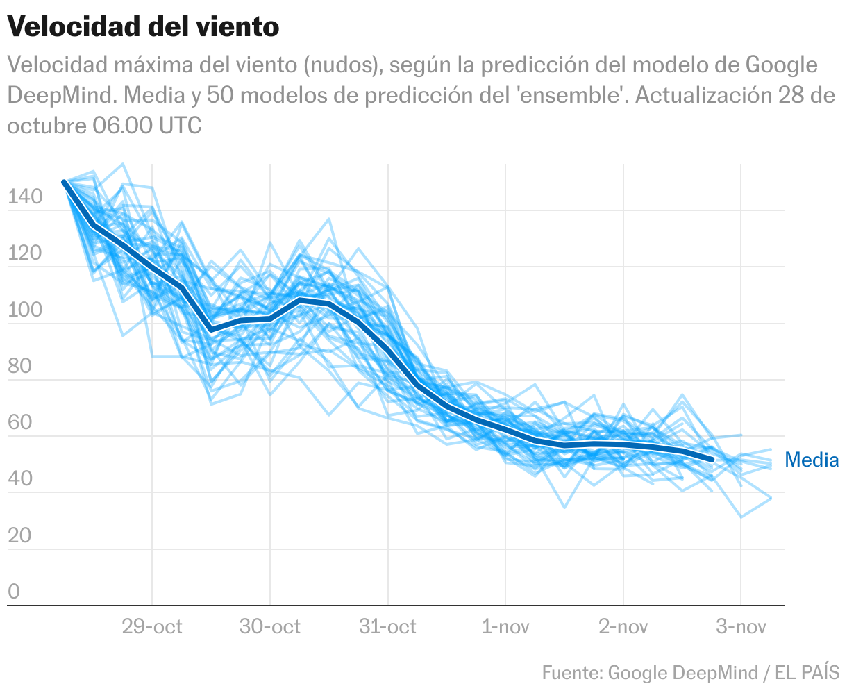
Wind gusts of more than 150 knots (270 kilometers per hour) have been recorded. For now, the predictions of the DeepMind model foresee a slowdown in wind speed, although during its trajectory on Tuesday and Wednesday it would continue above 100 knots maximum speed.
Other models, such as the NOAA model, predict a trajectory similar to that of the Google DeepMind model.
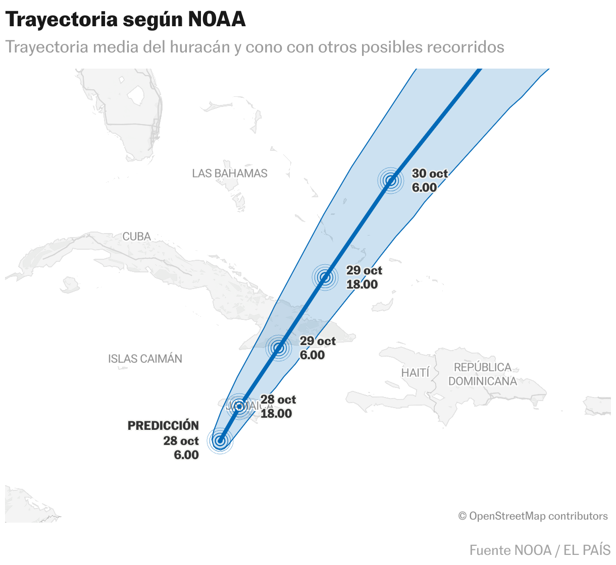
The cone of possible trajectories crosses Jamaica (central-west) and Cuba (central-east). On the first island, the cyclone threatens cities such as Mandeville and Montego Bay. In Cuba it could pass near Bayamo, Holguín and even Santiago de Cuba, although by then it could have weakened to level 3 intensity.
For more updates, visit our homepage: NewsTimesWire


